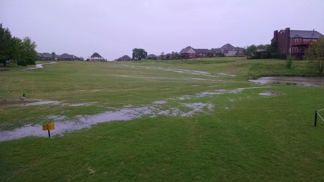
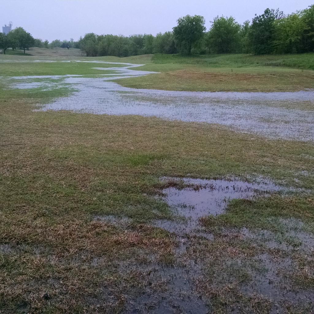
The winter storm Goliath, that is currently working it's way through the state, is leaving an incredible amount of rain across the eastern half of the state. The graph on the right shows the damage thus far. The golf course has had almost 7 inches of rain, and it's snowing right now. Look at Talequah with almost a foot of rain!! The upcoming week is forecasted to be dry with freezing temperatures at night and forties during the day. This freeze/thaw cycle will drag out the drying process and cause it to take twice as long for the turf to dry enough to remove cart restrictions.
Our friends at the Oklahoma Mesonet have a great run down on this recent storm and it's implications on the state records that have been broken. I've included a link to the article below:
http://ticker.mesonet.org/select.php?mo=12&da=28&yr=2015
The most interesting part of the information listed above, was the impact this week's storm will have on our total statewide precipitation average relative to history. It's clear this year has made history regarding the amount of rain that has fallen across the state.
WE HAVE NOW SMASHED THE PREVIOUS WETTEST YEAR ON RECORD FOR OKLAHOMA BY 5.83
INCHES!
Absolutely incredible. I don't know if you're quite getting it there. We just
topped the statewide average rainfall total by nearly 6 inches. Wow. There were
only 7 previous years above 47 inches, so let's rank them so you can see
the enormity of this new record.
2015: 53.71 inches (preliminary)
1957: 47.88 inches
1908: 47.24 inches
1915: 46.01 inches
1941: 45.83 inches
1923: 44.61 inches
1945: 41.82 inches
1905: 40.89 inches
Now we won't get the "official" total until later into January when NCEI releases
their statewide average, but safe to say it will be somewhere in the neighborhood
of 53-54 inches.
The place to get a behind-the-scenes look at grounds maintenance at Bailey Ranch Golf Club
Monday, December 28, 2015
Monday, December 14, 2015
Irrigation/Bunker Repair on #9
110 psi leaking out from mainline caused massive geyser |
This area was flooded for several days after water was shut off |
Last week, right of #9 fairway, a fitting on the irrigation system broke causing a very large leak. As you can see from the picture above, it caused a geyser about 100' tall. Once this section of the system was isolated, water continued to bubble and roll out of hole for most of the day. The entire middle portion of the fairway flooded as the water made it's way to the drain on the left side of the fairway. The force of the leak blasted enough soil, out of the ground, to fill a pickup truck bed. This soil came out of the ground and went right into the bunker. Once the water receded, it was clear that in order to clean the silt out of the bunker, all the sand would need to be removed. On Thursday of last week, all the sand was hauled away and on Friday 15 tons of new sand was added.
Silt contamination from leak |
New sand added and raked smooth |
Wednesday, December 9, 2015
#18 Cart Path Work
Last week, a local contractor, J&P Ventures, came out to replace a broken section of cart path behind #18 tee complex. A few years ago, the ground settled under this section of path which caused the concrete to buckle and sag, asphalt was placed as a temporary fix to smooth and level this area until it could be replaced. The contractor spent Wednesday afternoon breaking up and removing the old path and had the new concrete poured by Thursday afternoon. The forms were pulled Friday afternoon and the path was reopened for use. The only thing that remains to be done is a little dirt work and sod along the edges and this project will be complete.
Tuesday, November 10, 2015
Short Turf Pigment Application
Since our goal is to achieve a natural, green appearance, it was determined early on that a second application would likely be needed. We will plan on reapplying the pigment sometime in the next 3-4 weeks. This final application will provide a deeper, richer green that should last for most of the winter.
Monday, November 9, 2015
Driving Range Pigment Application
Last week, a green pigment was
applied to the driving range tee and target greens. It was
decided that having green turf on the targets would allow better depth
perception of the targets while practicing, and overseeding these areas with Ryegrass would be cost prohibitive, so a
green turf pigment was used to stain the semi-dormant turf green to make it
look like seeded Ryegrass. This kind of
process is a first for us, and so far we are happy with the positive feedback we’ve
received.
Wednesday, October 21, 2015
Clubhouse Patio Landscaping
Paint is used to mark the new bed shape, and the grass is killed w/ herbicide |
As our mowing schedules and other tasks have begun to wind down, I felt a need to address another issue at the clubhouse while we still had our seasonal help. The area directly north of the back patio has been an eye sore for quite some time. This area is in continuous shade and the Bermuda cannot fully grow up to the edge of the patio. This has created a muddy thin area that hasn't been much to look at.
A few weeks ago, the new landscape bed was outlined and herbicide was applied to kill the existing Bermudagrass. Earlier this week, Joe, our irrigation technician, redesigned the irrigation in this area to ensure the proper spray distribution. Yesterday, the staff installed new landscape edging, plants, rock paths, and mulch. The plants chosen for this bed are all tolerant of full shade and should acclimate very well to their new home. Each of them will also flower at various times to provide some seasonal interest throughout the year. This new bed certainly improves the look in front of the back patio, but it also removes the gap that existed in the landscape design which creates some continuity around the back of the clubhouse.
Plants and paths being installed |
All finished! |
Thursday, October 15, 2015
#5 Greens Surround Drainage
First, the trench is dug out |
Second, pipe is added |
Third, trench is backfilled with gravel |
Lastly, sod is replaced and topdressed smooth |
Tuesday, October 6, 2015
Fall Transition
The signs of fall are everywhere! The leaves are beginning to change color and some are even beginning to fall from the trees. The days are getting shorter and the nights are getting cooler. These changes in the weather also usher in a change in the growth of the Bermuda grass in our tees, fairways, and rough. We've noticed, over the past few weeks, a sharp decrease in the amount of grass we are cutting each time we mow. This means that we are able to mow less often, which affords us more time to work on other tasks. The staff has been able to catch up on all sorts of details, such as edging sprinkler heads and basins, topdressing divots, etc. In another month or so, we'll likely have our first frost and the Bermuda will then go dormant until spring.
Saturday, September 12, 2015
Fall Greens Aeration
This past week, the staff completed our fall greens aeration. A project like this is always a lot of work and the staff did an amazing job completing the project and still preparing the golf course for a busy weekend. Some rainy weather provided a few delays, but the staff was flexible, and we still accomplished our goals. I've written about the many benefits of the aeration process in the past, that information can be found here.
Now that aeration is behind us, we can begin the heal-in process. Over the next week, or so, the holes will gradually fill in, and the greens will get firm and smooth. We realize that everyone is anxious to get the greens back to normal, but appreciate everyone's patience during the next two weeks. Although aeration is seen as a huge inconvenience, the aeration process is critical to a sustainable, high quality surface year after year.
Monday, August 31, 2015
Course Update
#7 greens surround taken August 14th |
#4 fairway taken August 30th |
Removing thatch on #17 |
Removed a lot of organic during this process |
Applying nitrogen and growth regulator for color and density |
A fresh edge always improves the look of the bunkers |
Friday, August 14, 2015
How Come the Course is So Dry?
It seems hard to believe that the golf course could be this dry considering the torrential rains we had back in May and June. However, our typical dry, warm summer weather pattern has settled in and much of the soil moisture that was in the ground is now gone. To put in perspective, just how much it has changed, we've only received .75" of rain since July 9th. During this same time, our daily ET rates have averaged over .16". ET is an acronym for evapotranspiration, which is a measurement of water lost from the soil by a combination of water evaporating into the atmosphere and water that is used, or transpired, by the turf. That means that almost 5" of moisture has been lost out of the ground since July 9th, while only receiving .75" of rain. Now, of course we have irrigation to help compensate for the lack of rain, but with almost 11 million gallons of water that has been lost out of the ground over the past 5 weeks, our water supply is running low. As you can see from the picture below, our irrigation pond has dropped almost two feet. Almost two weeks ago, we began our summer water conservation program to keep as much water in our ponds as possible. As you play the course over the next few weeks, you'll continue to see the Bermuda go dormant. Please know that although the turf will turn brown, we are watering just enough to keep it alive and once the rain returns, the course will bounce back and look as green as it did earlier this summer.
As always, if you have any questions, or concerns, please feel free to contact anyone in the grounds department. Thank you.
Tuesday, July 21, 2015
Greens Venting
Tuesday, July 14, 2015
#12 Bermuda Sod Work
This morning, the staff began cutting out some weak areas around the outside of #12 green. These spots were the last remaining damage from the Leaf Spot outbreak we saw earlier this spring. As you can see from the picture to the right, there was a sizable spot in the approach, which we were glad to remove. There are also spots in the collar and along the backside of the green on both sides of the fan. Despite the intense heat, the staff did a great job finishing up the whole surround by the end of the day.
Please keep out of these areas as much as possible while playing through #12. Reducing the foot traffic in these areas will ensure a quick grow in. Once the sod roots in, we will begin to lower the height of cut down to the necessary level.
Wednesday, July 1, 2015
Fairway Slicing
This week, the grounds staff solid tine aerated fairways using our Aerway shatter tine machine. This machine has curved tines that twist under the surface as they come in and go back out of the soil. This slight twisting motion cracks the surrounding soil, loosening the clay to help improve air and water movement. Our goal is to use this machine 3-4 times throughout the season to ensure more consistent moisture in the soil, improved density and a healthier plant.
The process is quite simple. First, all irrigation heads and yardage markers are located to prevent damage. Then, the Aerway slicer is used to solid tine the fairways. Once this is complete, the fairway is then mowed to smooth the surface. Lastly, the fairways are blown off to provide a clean, smooth finished product. As you can see from the picture at the bottom of the post, the process creates very little disruption to the surface, while providing several key benefits to the soil below.
Thursday, June 25, 2015
Summer Tee Aeration
This week, the grounds staff performed our annual core aeration on tee boxes. Each summer, when the tees are aggressively growing, they are core aerated to keep them as healthy as possible for the rest of the season.
As has been stated before, core aeration improves oxygen content, drainage capabilities, and rooting. As you can see from the picture below, pulling the cores out of the ground makes a mess. Once the cores are pulled out of the ground, they are left to dry and then drug with a steel mat. This mat breaks apart the plugs and reincorporates the soil into the holes. The thatch and grass is left at the surface which is then blown off. The finished product is clean and ready for a mower.
Tuesday, June 9, 2015
Summer Greens Maintenance Program
Since the first of June, a much drier,
warmer, weather pattern has emerged. This drastic change in the weather has caused the grounds department to begin our summer greens management program. A key piece to our program is solid tine aerating greens every three weeks. The process creates tiny slits in the surface and, as you can see from the picture on the right, almost no disruption to the surface. The channels created loosen the soil, improve drainage, and increase oxygen content in the soil. All of which, will promote better rooting and a healthier plant throughout the summer.
Another major component to our greens management program is light, frequent topdressing. The type of bentgrass we have on our greens produce a lot of thatch during the warm summer months and frequent applications of sand keep the greens from getting too soft and puffy. The greens will also get a little soft from frequent hand watering, and topdressing is a great way to retain surface firmness during the summer months.
Speaking of hand watering, the staff went out last week for the first time this season to check greens. From now, until mid-September, there will be staff out every day making sure the greens have consistent moisture and are cooled off. Keeping the soil moisture slightly dry, and as consistent as possible, promotes firm putting surfaces.
While the three techniques described above aren't the only things we do during the summer to maintain healthy bentgrass, they are some of the most important. The grounds staff appreciates your patience and understanding this summer as we work to provide the best playing conditions possible. Thank you.
Tuesday, May 26, 2015
Rainy Memorial Day Weekend
Bunkers took the most damage |
However, the staff was able to repair them quickly |
I toured the golf course this morning after a rain filled Memorial Day weekend, and was pleased to see very little damage, other than bunkers. A total of 5" of rain fell over the weekend, which puts us at 13.50" thus far this month. The staff, began putting bunkers back together yesterday, for the sixth time, and finished this morning. The good news is that, although the ground is saturated and there is standing water in many places, the drainage we do have worked very well. It seems the course handled the heavy rain very well and the only place you can tell we had an extreme amount of rain is the high water mark in the tunnel, and some debris along creek banks. If we can dry out for a few days, and mow, we should be in good shape. There is more rain scheduled for tomorrow through Friday. Lets hope we miss some of it, we don't need any more for awhile.
The grass is laid over from the water flowing over the banks |
Besides being wet, the course faired well |
It's Official, Wettest Month in State History
As you can see from the title, we've already broken a 74 year old record for wettest month on record, and we still have more rain forecasted in the next week. Here is some more great information from the Oklahoma State Climatologist, Gary McManus:
MESONET TICKER ... MESONET TICKER ... MESONET TICKER ... MESONET TICKER ...
May 26, 2015 May 26, 2015 May 26, 2015 May 26, 2015
Mad May
http://ticker.mesonet.org/archive/20150526/madmay.png
Well, whenever post-apocalyptic madmen start releasing water, you know things
have gotten pretty bad. For those of you that missed the Ticker on Sunday, yes,
we have eclipsed the record for wettest May AND month for the state of Oklahoma.
After all the shenanigans this weekend, the statewide average for the month
thus far stands at 12.93".
12.93"!!!!!!
http://ticker.mesonet.org/archive/20150526/may1-26-totals.png
http://ticker.mesonet.org/archive/20150526/may1-26-pct.png
http://ticker.mesonet.org/archive/20150526/may1-26-stats.png
So our list of wettest Oklahoma months has a new sheriff in town, and we replace
that sheriff with each drop of water that falls between now and 11:59pm, May 31,
2015.
May 2015: 12.93"
Oct 1941: 10.75"
May 1957: 10.54"
May 1982: 10.38"
May 1943: 9.66"
Jun 2007: 9.51"
May 1902: 9.14"
Jul 1950: 9.07"
Again, we didn't just beat the previous record, we absolutely SMASHED it in this
"probably" El Nino-fueled enhanced southerly storm track with wide-open
moisture flow from the Gulf of Mexico. And it's not just Oklahoma, obviously.
This type of pattern impacts the entire Southern Plains.
http://ticker.mesonet.org/archive/20150526/last30days-SP.png
The good news is that the drought, for all intents and purposes, is over for
the bulk of the state. Most lakes are full or overflowing, some to the point
of catastrophe. Speaking of catastrophe, the bad news is that widespread river
and flash flooding has wreaked havoc on lives and property over nearly all parts
of Oklahoma. According to the OK Dept. of Emergency Management, 9 storm-related
deaths have occurred since May 5, in addition to 49 injuries.
More bad news, the rain and severe weather chances are not finished. The 7-day
rainfall forecast does not bode well for those areas of the state already
underwater or filled to capacity in soils, creeks and reservoirs.
http://ticker.mesonet.org/archive/20150526/7day-rainfall-forecast.gif
In early April, we would have killed for that type of rainfall forecast. Now, in
a cruel twist of fate, that type of forecast could literally kill. Severe weather
chances will go up again today. We'll let our friends at the local NWS offices
paint that picture.
http://ticker.mesonet.org/archive/20150526/nws-amarillo-svr.jpg
http://ticker.mesonet.org/archive/20150526/nws-norman-svr.jpg
http://ticker.mesonet.org/archive/20150526/nws-norman-svr-timing.jpg
http://ticker.mesonet.org/archive/20150526/nws-norman-tornado-pot.jpg
http://ticker.mesonet.org/archive/20150526/nws-tulsa-svr.png
And just in case you haven't noticed, it's been kind of chilly as well. I believe
we have probably set a few records for record low maximum temperatures over the
last several days. One of the things you'll see in a rainy month during the
warm season is a suppression of the high temperatures and little impact on the
low temperatures. The reason is pretty simple...the clouds and moisture act as
a shield to the suns rays during the daytime (hence, lower than normal high
temperatures) and a blanket at night, trapping heat that would normally radiate
away from the surface (hence, the preservation of the low temperatures). That's
exactly what we see in the Mesonet data for May thus far.
May 1-25 Statewide Average Mesonet Temperatures
Tmax Tmin Tavg
Measured 74.3 55.8 64.7
Normal 78.9 55.8 67.4
Departure -4.6 0.0 -2.7
The highest temperature we've seen on the Mesonet for May this year is 91
degrees at Altus back on the 18th. The high temperature at Woodward on the 20th
was 54 degrees, for crying out loud! That's like March, not May.
Some would say the lack of significant heat has saved us from an even worse
bout with severe weather, although the tornado numbers are stacking up. The
Norman NWS office has 32 twisters listed for May thus far, with 2 in April and
6 in March for a total of 40. Average for Jan-May is 38.4, so we're on track
to be above average thus far. That total of 40 will definitely be going up as
they investigate more damage paths.
The best news I've seen is the latest CPC precipitation outlook for June 2-8.
http://ticker.mesonet.org/archive/20150526/precip-outlook-jun2-8.gif
Increased odds for normal precipitation. I'll take it.
"What a lovely day!!" that will be.
Gary McManus
State Climatologist
Oklahoma Mesonet
Oklahoma Climatological Survey
(405) 325-2253
gmcmanus@mesonet.org
Friday, May 22, 2015
More Information on Recent Weather
For those interested, here is some great information from the Oklahoma state climatologist, Gary McManus, about our recent storms and their effect on drought and resevoir levels. I think it's interesting and worth sharing.
A Momentous Drought Monitor Map!
When you have rainfall amounts like this
http://ticker.mesonet.org/archive/20150521/30day-rainfall.png
and this
http://ticker.mesonet.org/archive/20150521/60day-rainfall.png
and soil moisture maps like this
http://ticker.mesonet.org/archive/20150521/2inch-soilmoisture.png
http://ticker.mesonet.org/archive/20150521/10inch-soilmoisture.png
http://ticker.mesonet.org/archive/20150521/24inch-soilmoisture.png
and a reservoir storage map that went from this
http://ticker.mesonet.org/archive/20150402/march23-reservoir-storage.jpg
to this
http://ticker.mesonet.org/archive/20150521/may19-reservoir-storage.png
is it any wonder that the U.S. Drought Monitor map for Oklahoma went from this
http://ticker.mesonet.org/archive/20150521/april14-DM-map.png
to this
http://droughtmonitor.unl.edu/data/pngs/20150519/20150519_OK_trd.png
in little over a month?
And what a momentous map that is (hence the title of the Ticker)! For the first
time since March 8, 2011, ZERO extreme or exceptional(D3 or D4) drought is
displayed within Oklahoma's borders.
http://ticker.mesonet.org/archive/20150521/march8.2011-DM.png
That map from March 8, 2011, still shows a state with 82% depicted as having
at least moderate drought, but the difference is that was when this 2010-15
drought was just beginning to intensify. The current map shows a drought which
is dying, and dying rather rapidly.
Before March 8, 2011, the previous time Oklahoma was noted with at least extreme
drought was back on August 12, 2008, in the far western Panhandle. Let's hope
the wait this time is much longer for its return, although 3 years or so isn't
bad.
http://ticker.mesonet.org/archive/20150521/aug12.2008-DM.png
Now the worst map in the history of the Drought Monitor for Oklahoma, going by
the amount of extreme-exceptional drought, occurred on August 7, 2012, with
97% of the state in at least extreme drought. Ugh, what an ugly shade of red
(shout-out to my OSU partners...that's a freebie!).
http://ticker.mesonet.org/archive/20150521/aug7.2012-DM.png
Although I still believe the map from October 4, 2011, with 70% of the state in
EXCEPTIONAL drought was probably the drought at its peak.
http://ticker.mesonet.org/archive/20150521/oct4.2011-DM.png
Now, if you're still worried by drought, or by a low lake, or by going almost
two days without flooding rainfall...give it a minute. Help is on the way. If
not this week, then possibly the next.
http://ticker.mesonet.org/archive/20150521/7day-rainfall-forecast.gif
http://ticker.mesonet.org/archive/20150521/may28-june3-precip-outlook.gif
Hey, we should have cake! Wet, soggy, water-logged cake.
Gary McManus
State Climatologist
Oklahoma Mesonet
Oklahoma Climatological Survey
(405) 325-2253
gmcmanus@mesonet.org
Friday, May 15, 2015
Is this Seattle?
The cloudy, rainy weather has been the big topic
lately. It seems that so far this spring, the sun just doesn't want to come out. Now, we always expect a fair amount of clouds and rain, but this year has been exceptional. According to the National Weather Service in Tulsa, it has rained 25 out of the last 44 days since April 1st. That's an amazing 57% of the time. As you'd imagine, this coincides with our rainfall totals being ahead of pace for the year. Based on the average monthly rain totals, we should be at 14 inches so far for the year. As of today, we are just over 20 inches for the year.
Wherever there's rain, there's clouds. Since April 1st, we've had at least 50% cloud cover 84% of the time. This almost constant presence of clouds has had a serious impact on the overall health of our Bermudagrass. As has been discussed before, Bermuda requires 8 hours of direct sunlight to reach it's maximum growth potential. Since the grass woke up from dormancy in late March, it hasn't been able to create enough energy on its own. Therefore, the turf's density and color are poor and the golf course hasn't reached it's full potential. I expect this weather pattern to break sometime in the next few weeks a more normal summer weather pattern to take hold. The staff has been busy fertilizing the Bermuda to encourage it as much as possible, but fertilizer will only go so far without heat and sunlight. Once we get into June, the temperatures go up, and the sun comes out, the golf course will look great.
Subscribe to:
Posts (Atom)